
South Pole
 •
by
•
by ScottBaiden
The South Pole, also known as the Geographic South Pole or Terrestrial South Pole, is one of the two points where the Earth's axis of rotation intersects its surface. It is the southernmost point on the surface of the Earth and lies on the opposite side of the Earth from the North Pole.
Situated on the continent of Antarctica, it is the site of the United States Amundsen-Scott South Pole Station, which was established in 1956 and has been permanently staffed since that year. The Geographic South Pole should not be confused with the South Magnetic Pole, which is defined based on the Earth's magnetic field.
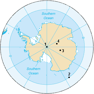
1. South Geographic Pole
2. South Magnetic Pole (2007)
3. South Geomagnetic Pole (2005)
4. South Pole of Inaccessibility
For most purposes, the Geographic South Pole is defined as the southern point of the two points where the Earth's axis of rotation intersects its surface (the other being the Geographic North Pole). However, the Earth's axis of rotation is actually subject to very small "wobbles" (polar motion), so this definition is not adequate for very precise work.
The geographic coordinates of the South Pole are usually given simply as 90°S, since its longitude is geometrically undefined and irrelevant. When a longitude is desired, it may be given as 0°. At the South Pole, all directions face north. For this reason, directions at the Pole are given relative to "grid north", which points northwards along the prime meridian. Along tight latitude circles, clockwise is east, and counterclockwise is west, opposite the way it is at the North Pole. The Geographic South Pole is located on the continent of Antarctica (although this has not been the case for all of Earth's history because of continental drift). It sits atop a featureless, barren, windswept and icy plateau at an altitude of 2,835 metres (9,301 ft) above sea level, and is located about 1,300 km (800 mi) from the nearest open sea at Bay of Whales. The ice is estimated to be about 2,700 metres (9,000 ft) thick at the Pole, so the land surface under the ice sheet is actually near sea level. The polar ice sheet is moving at a rate of roughly 10 metres per year in a direction between 37° and 40° west of grid north,down towards the Weddell Sea. Therefore, the position of the station and other artificial features relative to the geographic pole gradually shift over time.
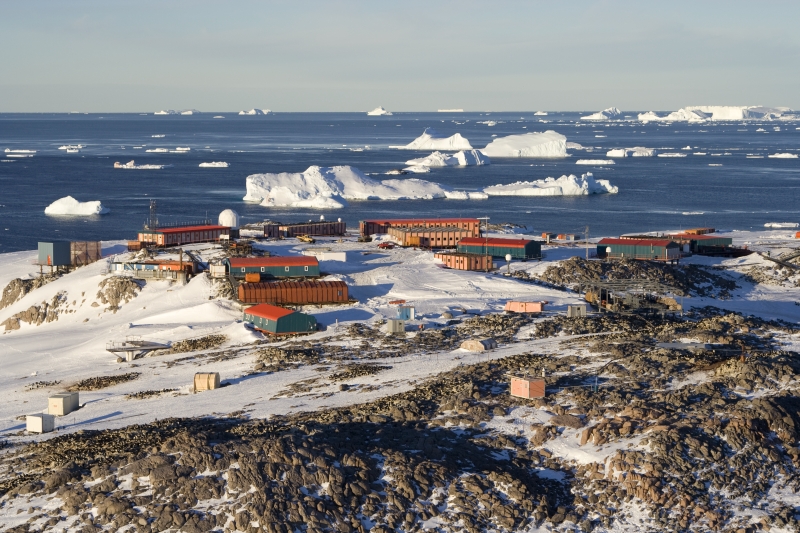
Dumont - Urville station
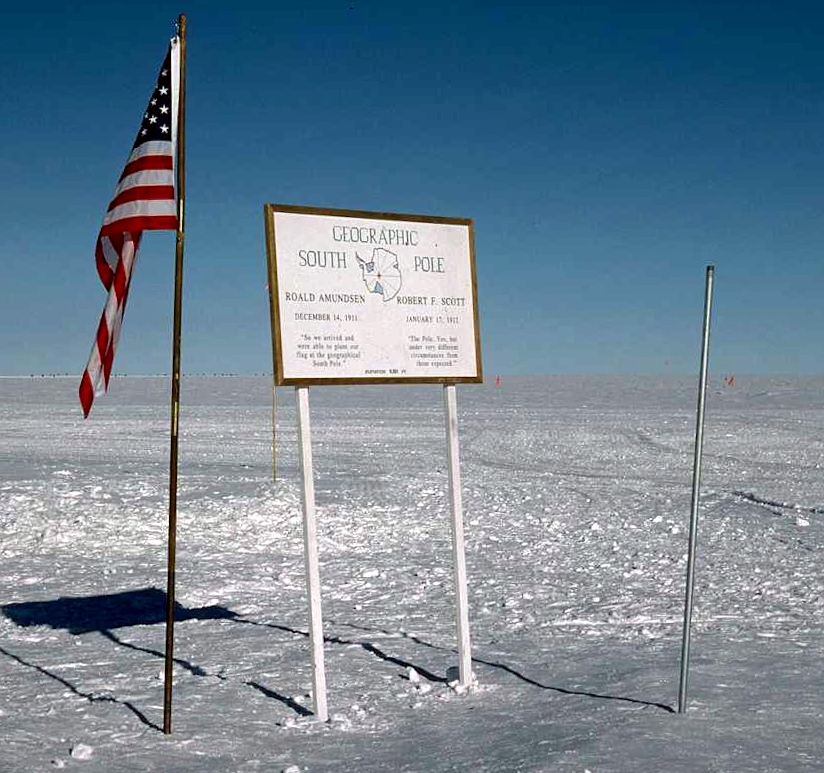
The Geographic South Pole is marked by a ceremony on New Year's Day in which a small sign and American flag are moved, and newly revealed annual stake is placed in the ice pack, which are positioned each year to compensate for the movement of the ice. The sign records the respective dates that Roald Amundsen and Robert F. Scott reached the Pole, followed by a short quotation from each man, and gives the elevation as "9,301 FT.". The current stake has the position of the planets, sun, and moon on January 1, as well as a copper star marking the pole.

The Amundsen–Scott South Pole Station
Comments
o/
x
777
v
v
Interesting 🙂
o7
o7
o7
V+S!
right o7